

The Karlstalschlucht hike near Trippstadt packs a lot into 10.3 km — gorge, castle, pond and forest paths.
Some circular trails tick one box. The rundwanderweg-karlstalschlucht near Trippstadt, in the Landkreis Kaiserslautern, ticks about six. Over 10.3 km and a modest climb to around 456 metres, you move through a sequence of scenes that feel almost deliberately staged: a pond fringed with vivid green, a red sandstone portal ruin half-swallowed by the forest, a baroque palace garden baking quietly in the summer heat, and a church tower peeking above the tree canopy like it has been there forever — because it has.
Starting out: the pond and the mallards
The trail begins in the centre of Trippstadt, and within the first few minutes you reach a calm pond where, on a summer morning, a pair of mallards slip silently across the water. The light filters through overhanging branches, the reflections shift, and the whole thing feels completely unhurried. A moss-covered fallen tree stretches over a second stretch of water further along, its branches half-submerged, duckweed covering the surface — exactly the kind of near-natural riparian corner that reminds you why this valley was declared a nature reserve back in 1983.
Through the castle park and down to the gorge
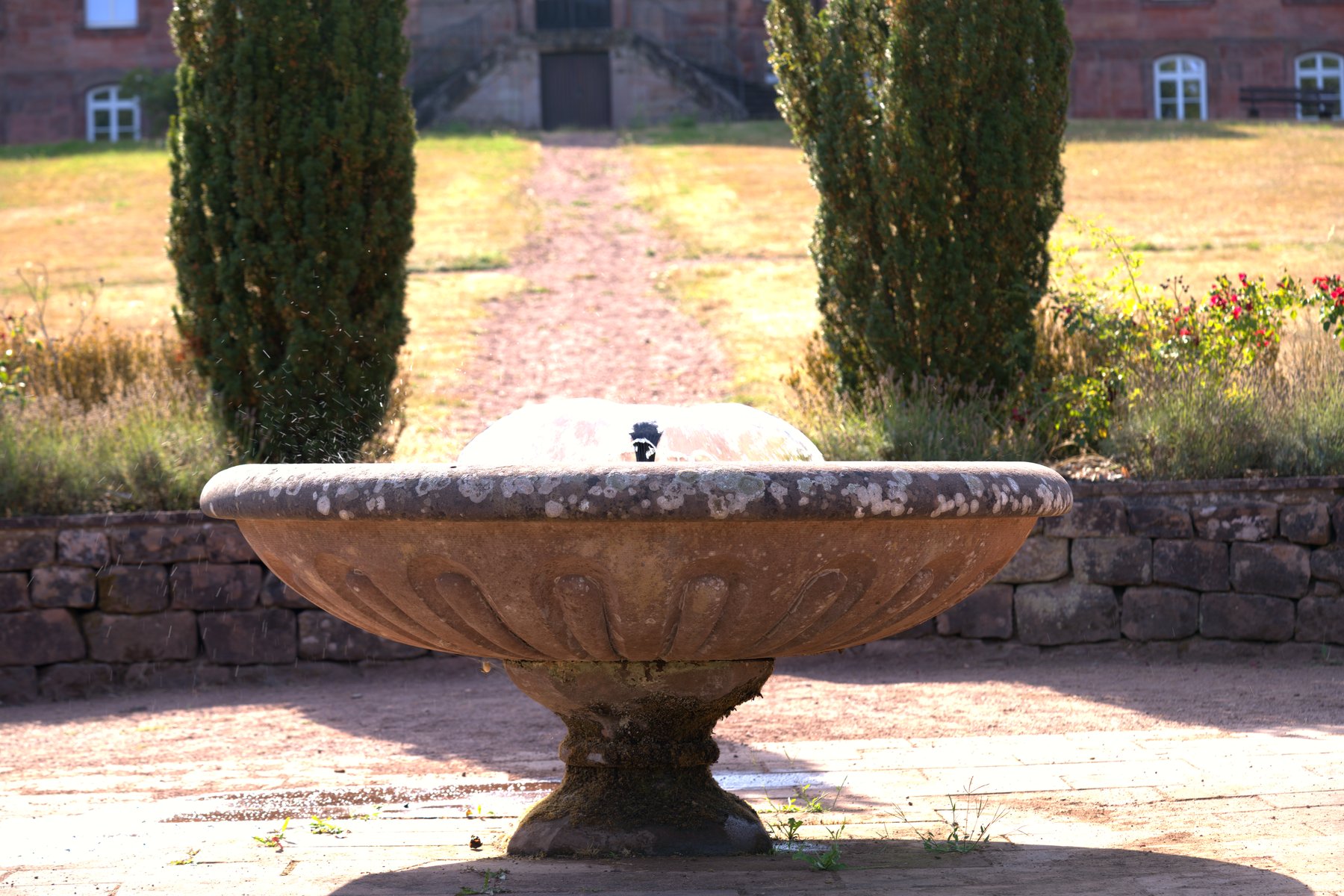
The route heads west from the town centre to Schloss Trippstadt, a baroque palace built in 1766 from red sandstone. You pass through a wrought-iron gate into the formal garden, where a stone fountain with decorative reliefs stands on a garden terrace — cypress trees rising behind it, the historic brick façade catching the afternoon light. The whole scene looks like it belongs on a postcard, but it is also genuinely lovely to walk through on a warm day, even when the grass is scorched and the air is dry.
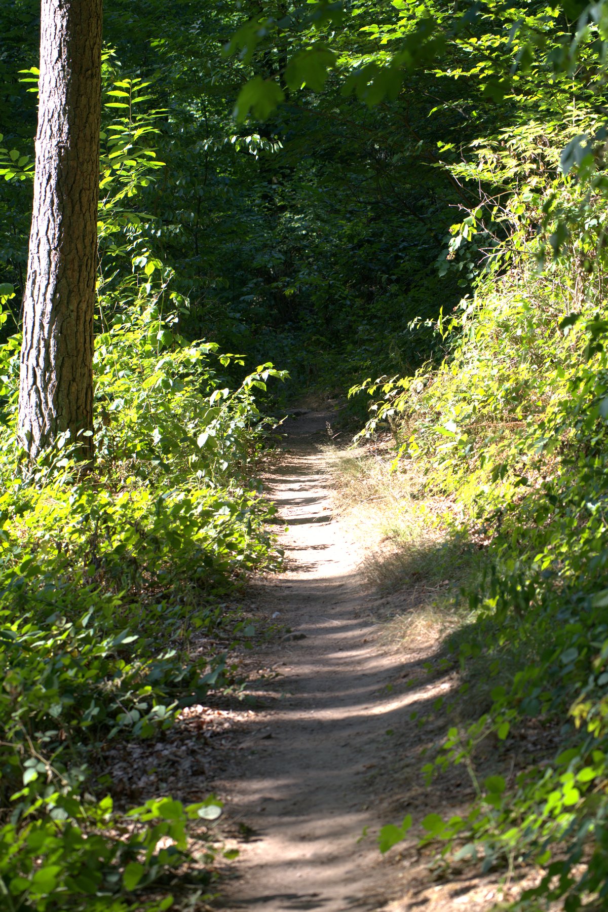
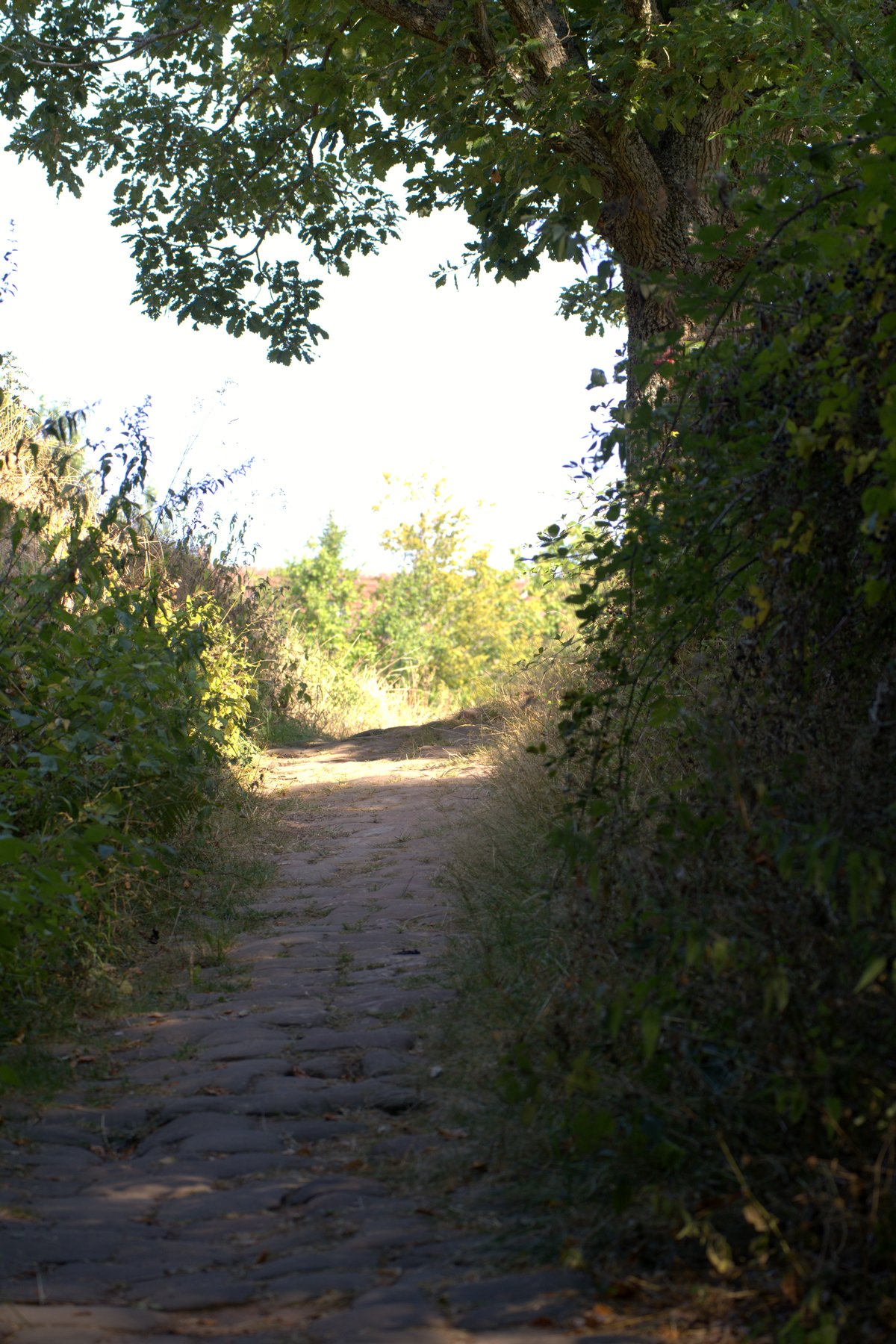
From the park you drop steadily downhill through a narrow valley towards the Karlstal. The trail here narrows to a dirt path winding through deciduous forest, dappled light and shade alternating across the sandy ground. Cobblestones appear underfoot on one section, worn smooth over centuries, the vegetation arching overhead in a tunnel of green. A little further along, the red sandstone portal ruin of Burg Wilenstein appears through the trees — a striking fragment of masonry standing quietly amid summer foliage. Worth pausing at.
The Karlstalschlucht itself
The gorge section is the centrepiece. The route over many small bridges through the sandstone ravine of the Karlstal is genuinely impressive — boulders, ferns (almost every fern species found in the Pfälzerwald grows here), and the sound of water alongside you. What is worth knowing: Friedrich Ludwig Sckell, the same landscape architect who designed the English Garden in Munich, shaped this valley as a natural park in the 18th century. That history sits lightly on the place — it just feels wild and beautiful — but it explains the unusual combination of cultivated and natural that runs through the whole route.
At Klug’sche Mühle (Wielensteiner Mühle) you re-emerge from the gorge onto a road briefly, before the trail climbs back up through beech woodland towards the Sägmühlweiher pond. The Camping- und Freizeitzentrum Sägmühle offers food and cold drinks here — very welcome in summer.
The return: village lanes and a church tower
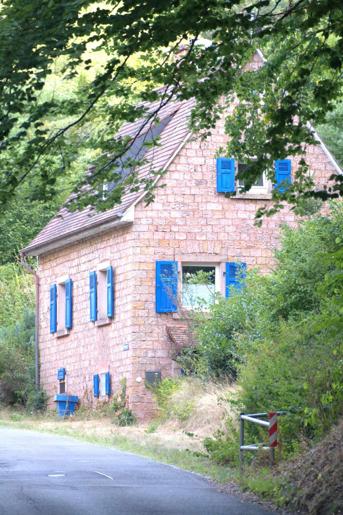
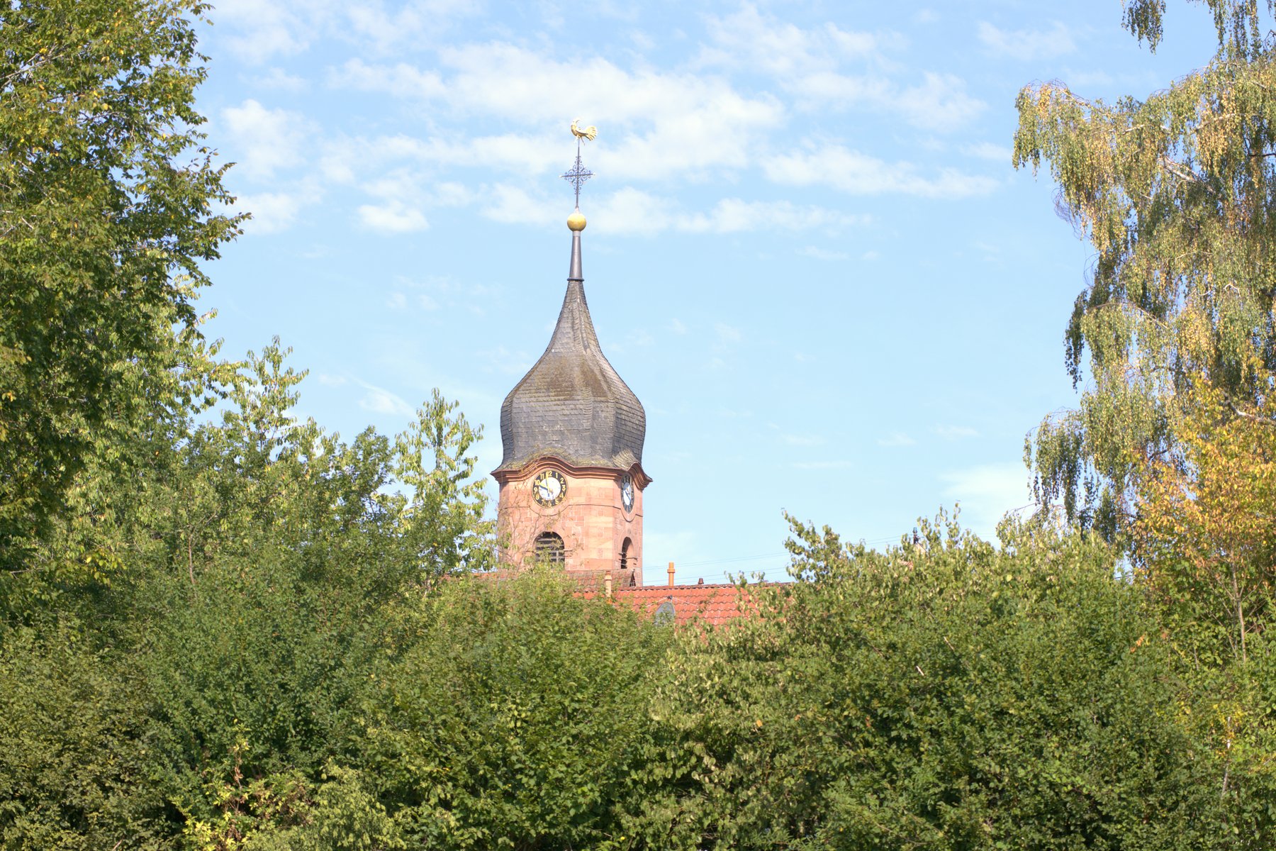
The final stretch back into Trippstadt passes through the quieter lanes of the village. A rustic sandstone house with vivid blue shutters appears alongside the road, half-hidden in greenery. Further along, a narrow path leads towards a half-timbered house with a bright yellow façade and red tile roof — the kind of rural idyll that northern European villages do without trying. And then, framed by summer tree canopy, the curved spire of the village church comes into view, its golden orb and weathercock catching the light above the rooftops.
Practical notes
- Start/finish: Town centre of Trippstadt, Landkreis Kaiserslautern — parking at the town hall or at the Waldfreibad.
- Getting there: By car via the A6 to Enkenbach-Alsenborn, then the B48 to Trippstadt. By bus: line 170 to Bürgermeisteramt Trippstadt.
- Distance and elevation: 10.3 km circular, lowest point around 308 m, highest around 456 m — nothing extreme, but the gorge path is rocky in places.
- Footwear: Sturdy trail shoes are essential; the gorge trail crosses stream sections and loose stone.
- Food: Klug’sche Mühle (garden restaurant) en route; Sägmühle at the pond for a mid-hike stop.
- Crowds: Weekends get busy at the gorge — arriving early in the morning secures parking and a quieter experience.
- Season: The trail runs through summer beautifully, especially in the forest sections where the canopy keeps the temperature down.
One tip worth keeping in mind: the trail is waymarked with a distinctive logo (a pavilion on a green background), so navigation is straightforward even without GPS. The Komoot route (ID 3201773520) also tracks it cleanly if you want a backup on your phone.